Why a Coastline Can Make a Short Journey Feel Long
A coastline can make a short journey feel long for good reason. Read headlands, inlets and map contours to choose a route with changing views.
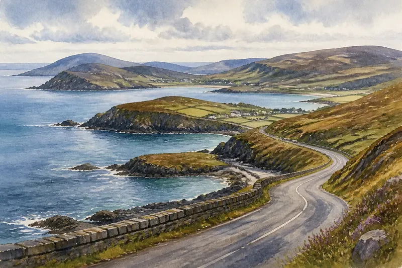
Why can a coastline make a short journey feel long? A coastline can make a short journey feel long because each headland, inlet, and bend changes what you can see, even when the road covers little ground. If you are choosing a coastal drive, the map’s outline can tell you whether the day will bring a varied sequence of views or a more direct run beside open water.
Read the shoreline’s shape
A straight stretch of coast tends to offer a steady view: sea on one side, land on the other, with few changes in direction. A deeply indented shore works differently. Roads may turn around bays, cross narrow necks of land, or run inland before returning to the water. The distance between start and finish can look modest while the route keeps changing its angle.
Headlands create one kind of rhythm. As a road approaches a projecting point, the water may slip from view behind rising land. After the road rounds it, a different bay or stretch of horizon opens up. Inlets create another: a road can follow the shore inward, then curve back toward the mouth, making the journey feel like a series of arrivals and departures.
Think of the coastline as a paper ribbon folded on a table. The ends may sit close together, but tracing the ribbon takes longer than drawing a straight line. The analogy has limits—roads do not follow every crease—but it helps explain why map distance alone can understate the sense of travel.
Choose by your day
If you have limited time and want to reach a particular place, favor a route that cuts across a peninsula or follows a straighter inland road. It may show less water, but it avoids repeatedly tracing the edge of bays. Check that the road actually connects the places you need; a narrow neck on the map does not necessarily mean a simple crossing.
If the journey itself is the point, choose a route that curls around one or two large inlets and passes several headlands. That pattern often gives the day a clear sequence: approach a bay, turn away from it, then meet the sea again from another direction. Look for places where a public road or path reaches a viewpoint, rather than assuming every attractive projection offers a place to stop.
If you want a relaxed outing with frequent pauses, favor a coast with settlements, lay-bys, or signed viewpoints spaced along the route. Those give you choices when a view catches your attention or the weather changes. A remote, tightly winding shore may be rewarding, but it can offer fewer convenient places to take a break.
If you are traveling with someone who dislikes repeated bends or a passenger who needs a predictable ride, choose a more direct road and treat the coast as a destination rather than a continuous drive. A map cannot tell you exactly how a road feels, but a dense pattern of sharp turns is a useful reason to look for another approach.
Look for map clues
Start with the shoreline, then trace the road rather than measuring a straight line between towns. A road that hugs every curve is likely to bring frequent changes in direction and view. One that cuts across the base of a peninsula may be shorter in both distance and time, though it will leave some coves and headlands unseen.
- Look for projecting points. A headland can signal a turn in the road and a possible change of outlook.
- Trace the mouths of bays. If the road runs deep into an inlet, expect it to follow the water before turning back.
- Compare both sides of a peninsula. A cross-peninsula road can offer a quicker connection; a shore-hugging loop offers more coastline.
- Check for bridges and ferry links. These can shorten a route across an inlet, but their availability and operating details depend on the specific service.
- Find stopping places before setting out. Viewpoint symbols, parking areas, and settlements help show where a pause may be possible.
- Notice the land between road and sea. Contour lines close together suggest steeper slopes, which may block views even when the road is nearby.
Map symbols and road access vary, so check the map legend and any relevant local or service information before relying on a particular stop or crossing.
What does the map tell you?
Does a coastal road always stay beside the water?
No. A road may climb inland to cross higher ground or skirt a bay where the shore is steep or inaccessible. Follow its line alongside the contours and settlements rather than assuming that proximity on the map means an uninterrupted sea view.
How can you spot a varied route?
Look for a sequence of bends around headlands, entries into bays, and changes in the direction the road faces. A route that alternates between following the shore and turning inland is more likely to offer distinct outlooks than one that runs parallel to the water for a long stretch.
Is a loop better than an out-and-back drive?
A loop can show you different sides of the coastline, especially if it crosses a peninsula on its return. An out-and-back route is simpler to plan and lets you revisit a view in different light, but the scenery along much of the road will be familiar on the way home.
What if the road looks close but the journey seems long?
Trace each bend and inlet, then compare the road’s route with the direct line between your endpoints. A long coastal detour may be the appeal if you have time for stops; if you have a fixed arrival, look for a cross-country connection or a shorter return route.
Picture a route
Say you have a free afternoon and are choosing between a direct road to a village and a longer-looking loop around a broad bay. The map shows the direct road crossing a narrow neck of land, while the loop follows the shore, rounds two headlands, and passes a marked viewpoint. If you want a varied outing, the loop fits because its turns promise changing angles and a natural place to pause; if you need to arrive promptly, the cross-peninsula road fits better.
Before choosing, check the route at the scale you will use on the day. A broad map reveals the shape of the coast, while a closer view can show road connections, stopping areas, and where the route turns away from the sea. For a coastline that can make a short journey feel long, that small change of map scale helps you decide whether you want the shoreline’s full unfolding curve or simply a good view along the way.